

Spatial Data
.png)

.jpg)
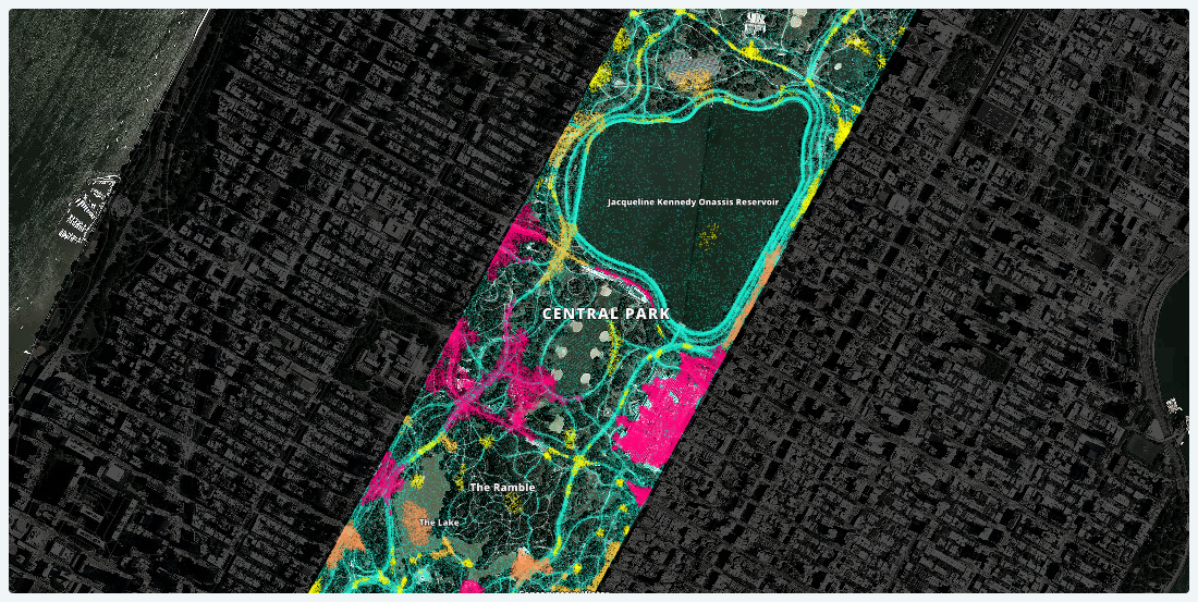

Lessons Learned from Analyzing Over a Million Points of GPS Data
Working with one month of nation-wide GPS data, A Million Walks in the Park explores the use of public spaces, specifically public parks across New York City, to understand social interactions among New Yorkers.

Global Partnership: Democratizing Data & Location Intelligence for Development
Democratizing Data & Location Intelligence: The Global Partnership for Sustainable Development Data is Working Towards the SDGs

4 Ways Data Enrichment Can Improve Your Raw Business Data
Implementing data-driven decision making can only show a return on investment for businesses if analysts ask the right questions with the right data. Here are the right questions to ask.

Academy


CARTO & Snowflake: Location Intelligence for Energy and Utilities
CARTO and Snowflake expanding cloud-native Location Intelligence for Energy and Utility organizations, unifying IoT data for resilient operations.
Nagarro & CARTO: Advancing Enterprise AI Transformation
CARTO and Nagarro partner to help enterprises move AI from pilots to production, embedding Location Intelligence into existing workflows and systems.


Unlock trade-area analysis at scale with H3 Isochrones
Scale travel-time analysis with H3-based isochrones in CARTO. Faster joins, overlap insights, and 96–99% time savings powered by TravelTime.