


CARTO & Snowflake: Location Intelligence for Energy and Utilities
CARTO and Snowflake expanding cloud-native Location Intelligence for Energy and Utility organizations, unifying IoT data for resilient operations.


Charting New Terrain in eCommerce with Pitney Bowes
CARTO partners with Pitney Bowes to integrate location intelligence into global commerce, enhancing data visualization and analysis


Creating Animated Maps with CARTO Builder
Explore the power of Torque.js, offering innovative geospatial data aggregation for both time and space. Animate and analyze data trends effortlessly!


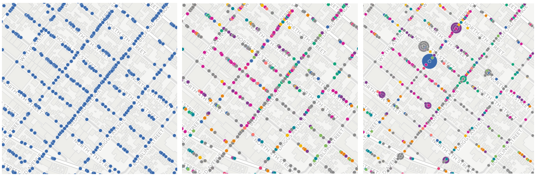
Hurricane Season 2016: Locating Resiliency in Sandy's Aftermath
CARTO aids NYC's Mayor's Office in tackling climate change, visualizing risks, and preventing disasters like Hurricane Sandy. Explore OneNYC's efforts.

The Revolution will be Visualized: CARTO joins PREP
Discover CARTO's role in the Partnership for Resilience and Preparedness (PREP), empowering global climate resilience planning.

CARTO’s Open Data Week 2016 Preview
Immerse yourself in the world of Open Data at CARTO's Madrid event! Engage with global innovators, explore workshops, and join discussions.

Geospatial Learning Across the Curriculum at NYU
NYU collaborates with CARTO to enhance GIS learning, enabling students to utilize location intelligence across disciplines.


Academy

3 ways Location Intelligence is changing outdoor advertising
See how leading OOH companies use cloud-native spatial analytics and AI to move beyond impression counts and prove campaign ROI.
CARTO & Snowflake: Location Intelligence for Energy and Utilities
CARTO and Snowflake expanding cloud-native Location Intelligence for Energy and Utility organizations, unifying IoT data for resilient operations.

How to get your colleagues and clients excited about geospatial
A practical guide to building internal buy-in for geospatial, with tips on making the case to non-technical colleagues and leaders, speaking the right language.

